"Winter Way" of “Camino de Santiago”"
(Also known as "Camino Francés” -French way-)

(Medium difficulty)

The Winter Way is an ancient variant of the Camino de Santiago Francés. Since 2016, it has been recognized as a Jacobean route by the Xunta de Galicia.

In this content, you will discover why it is one of the most popular routes in the Ribeira Sacra, and it is full of activities to do! Do you want to discover them? Keep reading.

Faldon logos

Would you like more information about this route?

You can contact us for more information on how to complete this route.

What is the Winter Way of the Camino de Santiago?

With the arrival of winter, snowfall covered the mountains of the French Camino de Santiago in Os Ancares and O Cebreiro, often closing the route to pilgrims.

Travelers, some of whom came from Central Europe, had two options: spend the winter in Ponferrada or follow the course of the Sil River to avoid the snow.

Pilgrims who chose to continue their journey through the Sil Canyon passed through several towns such as A Rúa and Quiroga. After leaving the Sil River behind, they ascended to Monforte de Lemos, then crossed the Miño River to reach Chantada. Further on, they reached Monte Faro to finally achieve their coveted goal: Santiago de Compostela.

Why choose the Winter Way of the Camino de Santiago?

Pilgrims have various options when choosing which Camino de Santiago route to take.

The reason to choose this option is that along this route, you can discover some of the treasures offered by the Ribeira Sacra: the Romanesque architecture of its churches and monasteries, its beautiful landscapes, heroic viticulture, its villages, its people, and its ethnography.

There are four stages that pass through the Ribeira Sacra, leaving three more stages to reach Santiago de Compostela, the desired destination.

Why choose the Camino de Santiago with Arribeirados?

At Arribeirados, we have extensive experience in organising customised routes through the Ribeira Sacra. More and more people rely on us to complete the Camino de Santiago for various reasons, including:

Tranquility

Arribeirados will prepare the Camino tailored to your needs. We take care of preparing a complete package that includes where to eat, where to sleep, and transfers.

Convenience

We will take you to the starting point of the Camino in our vehicle, handling the transportation of your luggage from the starting point to the next accommodation point.

Assistance

We will serve as your support car during your journey, being available for anything you need.

A more complete experience

We will organise complementary activities to the Camino, such as guided visits to some of the Romanesque treasures, entrance to some of the museums in the area, visits to some of the viewpoints overlooking the Sil Canyons, and river routes.

No need to plan anything

You will enjoy the Camino de Santiago without a backpack, without having to spend a lot of time preparing, and without having to make reservations.

Because Arribeirados will prepare the Camino de Santiago for you and your group of friends or family!

Who can do the Winter Way of the Camino de Santiago?

We must start by saying that it is not a hiking route; it is a long-distance route, and travellers must be prepared to walk routes of up to almost 35 km. Some stages have significant elevation changes, so physical preparation before undertaking the Camino is necessary.

How to organize the Winter Way of the Camino de Santiago?

As it is a long-distance route that takes several days, several aspects need to be considered, from your physical capabilities to the number of days you have available, your interests, and the purpose of your Camino.

The Camino de Santiago does not have to adhere to the “established” stages. You can personalise your Camino according to your needs and preferences. You do not have to search for the Camino; the Camino will find you, and you will discover it together.

When to do the Camino de Santiago?

Any time is good, both existentially and seasonally, to undertake the Camino. Personally, we love spring and autumn.

The winter season is a bit complicated because in some sections, small streams cross the path, making it difficult to walk. You may have to take alternative routes.

Where does the Winter Way
of the Camino de Santiago start?

The Winter Way starts in the town of Ponferrada. The first contact with the Ribeira Sacra is in the town of A Rúa. Below, you can learn more about its different stages.

1st Stage: A Rúa – Quiroga 28 km

We will be amazed by the sight of the Montefurado Tunnel, a true Roman engineering marvel. The Romans believed that everything was possible if the goal was to obtain gold, the precious metal of the Sil River.

We will encounter the castle-fortress of Os Novaes, once the residence of the Hospital Order of the Knights of St. John, now in ruins but impressive from its watchtower.

Finishing in Quiroga, where we can enjoy what this town of just 3,300 inhabitants has to offer: its museums, its traditions, its murals…

We begin our journey through our beloved Ribeira Sacra, and you can feel it with every step.

In this stage, of low difficulty, we can enjoy many of the characteristics of this area of the Ribeira Sacra: the olive trees, the black slate, the reddish tones, its villages, its legends, and the ever-present Sil River, with its gold and meanders, will accompany us on this beautiful journey.

A Rúa-Os Albaredos (8km)

It’s a route on an asphalted road, but with hardly any traffic. We can enjoy the winding views of the meanders formed by the Sil River.

Upon leaving A Rúa de Valdeorras (Ourense, 4,700 inhabitants), we will take the LU-933 / OU-933, known as the old road, which leads us to Monforte de Lemos.

Once we leave A Rúa and start ascending, if we look back, we’ll see the tail of the San Martiño reservoir, 25 meters high and built in 1956.

Both the railway line, which connects Palencia with A Coruña, and the national road N-120 follow a winding path halfway up the slope.

We pass through Os Albaredos (Lugo), a small town with only 10 inhabitants, leaving the Chapel of Santa Bárbara on the left.

Os Albaredos – San Miguel de Montefurado (2.3km)

Descending from Os Albaredos, we’ll pass through olive groves, walnut trees, and fig trees. Later, we’ll walk along a path made of slate stones that leads us to the Ferreiros stream, which we’ll cross over an ancient bridge, with an old mill and a railway bridge in front of us. The path parallel to the railway line takes us to the Montefurado train station.
San Miguel de Montefurado

We enter San Miguel de Montefurado (Lugo, 100 inhabitants). In a small and charming square, there is a baroque church with the same name, built in 1759, with a rococo altarpiece. The rusty color of its “cabeleira” stone, produced by the metallic impurities in the stone, is particularly striking.

Iglesia de San Miguel de Montefurado
Restos de “ruina montium” en Montefurado

We wander through its narrow streets with reddish houses and slate roofs, admiring some of the “corredores” (narrow passageways protected from rain). Some houses are abandoned but still retain their charm. The ground floors on the street level used to house cellars or stables.

To the left is the Montefurado Tunnel in the Sil River.

During the time of Trajan, 2nd century AD, it was decided to build this tunnel to divert the course of the Sil River and extract the gold deposited in the meander formed by the river.

The tunnel, which currently measures 54 meters in length, 19 meters in width, and an average height of 17 meters, measured 120 meters in length in 1934.

Due to a major flood on November 6, 1934, a collapse occurred, causing a landslide in the tunnel. In this collapse, the Castillo de la Pena do Corvo (Castle of the Crow’s Rock) was destroyed, of which there is only oral tradition and some engravings from 1888.

The fallen rocks blocked the Sil River’s path, causing it to return to its original course through “As Veigas.”

The repair works were completed in 1941, leaving the tunnel as it stands today.

Today, the vibrations from the N-120 road along with floods threaten the conservation of this great work of Roman engineering.

Just outside our route is the Anguieiros viewpoint, from where you can see the Montefurado Tunnel with the town of San Miguel in the background. Another option is to visit the village of Os Covallos.

We recommend reading “A Boca do Monte” by Celia Díaz Núñez, a novel in which the author shows us what the life of those men and women used as labor for the construction of such an engineering marvel could have been like.

San Miguel de Montefurado – Bendilló (8.2km)

We climb to O Ermidón, a small village with only about 10 inhabitants. The ascent rewards us with beautiful views of the Montefurado Tunnel and some small “médulas,” remnants of Roman mining operations using the “ruina montium” technique.

The views we contemplate during this journey are very beautiful. Let’s enjoy the peace they transmit!

After 3 km of walking, we reach some old buildings that were once inns. One served as a tavern, and the other was a hostel, not only for people but also for horses.

We leave the road that offered us such great views and turn right onto a dirt path that crosses vegetation typical of the Mediterranean climate, with cork oaks, delicious medronho trees, oregano, chamomile… a treat for the senses.

We descend to the A Escrita stream. After a small ascent, we arrive at the Chapel of San Juan das Farrapas, with a covered porch where pilgrims would discard their old and worn-out clothes, the rags (“farrapos”), which were then burned.

Nearby, we find an old olive oil mill, over 300 years old, which was restored in 1993 and still produces artisanal olive oil for the “Fiesta del aceite de Bendilló” (Bendilló Olive Oil Festival).

It is essential to note that Quiroga is well-known for its liquid gold: olive oil, which was already processed in Roman times.

We ascend to the village of Bendilló, a village with 16 inhabitants, featuring its parish church, Santa María, made of stone and mud with a slate roof.

Bendilló - Soldón (1.7km)

We start a steep descent on a dirt path from which we can contemplate some of the most beautiful meanders of the Sil River.

We cross the N-120 road through an underpass and approach the small village of Soldón, named after the river that bathes its lands and features typical houses with corridors.

We find a recreational area at the point where Soldón flows into the Sil River, and in summer, a small kiosk offers refreshments, allowing us to rest and recharge for the rest of the route.

This beautiful place is a stark contrast. Would you like to discover the reason?

Soldón – Os Novaes (3.1km)

We head towards Sequeiros on the left bank of the N-120 and take a detour onto a local road to the left. We don’t enter the village but turn right, passing under a passageway.

The dirt path, with a steep incline, takes us to the castle of Os Novaes, belonging to the small village of the same name.

As we have seen, every effort is rewarded, and this time is no different. The ensemble formed by the castle and the surrounding houses is incredibly beautiful.

Castillo de Os Novaes

As a residence of the Sovereign Military and Hospitaller Order of St. John of Jerusalem, Rhodes, and Malta, known as the Order of Malta, and its proximity to the Quiroga Encomienda, indicates the importance of this route for the Order.

This Order was responsible for establishing hospitals for the care of pilgrims from the 13th century onwards. The Order retained its possessions until the disentailment, a period during which the construction was abandoned.

The tower, with a square plan, dates back to the 10th century, and its thick walls indicate its defensive purpose.

The palace, with a trapezoidal plan, dates back to the 12th century and rises on a castro (fortified settlement). We can see the Maltese cross on its facade.

Today, we can distinguish moats, remains of walls, gates, and windows. All of this is in the rusted red color, as it was built with “cabeleira” stone. Its sight takes us back to the medieval era, and we can imagine the monks receiving pilgrims…

Legend of the Young Lovers

Long ago, in the castle lived a maiden with golden hair, the daughter of the lord of Torrenovaes.

The girl maintained a love affair with a peasant boy from the other side of the Sil River. The lovers would meet in the passageway that connected both shores, below the river.

One day, the castle’s lord discovered this relationship and decided to punish the two young lovers. One night, when the lovers met, the castle owner ordered the exits to be sealed, leaving the lovers trapped inside.

The gold nuggets from the Sil River are the maiden’s golden hair. And on moonlit nights, you can hear the lovers’ sighs of love.

Os Novaes – Quiroga (4.7km)

After delighting in the views offered by the castle, we descend to a small square to take a dirt path that leads to a very high medieval bridge that crosses the Os Novaes stream.

As we have noticed, what goes down must come up, so we begin the ascent on a path of pebbles, the old royal road, where we can discover the traces of ancient carts. We’ll see the beautiful castle that we left behind, seeming to precipitate itself over a ravine.

Once at the top, we enter the Quiroga valley, which, due to its oceanic-Mediterranean microclimate, has numerous fruit trees, olive groves, and vineyards.

We pass through the places of San Xulián de Arriba and Caspedro, leaving a small chapel on the left.

The descent takes us, after crossing the medieval Ponte Pedriña bridge, into Quiroga through the Real Street.

*In Caspedro, we can explore an alternative route, the Old Road, which will take us to the Set of San Salvador de O Hospital, with a pre-Romanesque church, the blazoned houses of the Encomienda, and a beautiful stone cross.

From Hospital, the path leads us to the Chapel of A Ermida, located on a castro (hillfort), and its atrium serves as a natural viewpoint over the beautiful valley. In this chapel, the Crismón de Quiroga was found in the 5th century.

Crismón de Quiroga

We are talking about a circular marble piece weighing 120 kg and measuring 95 cm in diameter, with an inscription in Latin and some Greek letters. It is considered one of the oldest Christian representations in Galicia.

Currently, the original is in the Diocesan and Cathedral Museum of Lugo, and a replica is found in the Church of A Ermida in Quiroga.

Quiroga

This town in Lugo has around 3,200 inhabitants, and like in almost all municipalities in the Ribeira Sacra, the average age of its population is quite high.

Talking about Quiroga means talking about the Sierra do Caurel and the rivers that make up its river network: the Sil River as the main river, and the Quiroga, Soldón, Selmo, and Bibei rivers as secondary ones.

In Quiroga, you can find everything from two recently built museums to beautiful mountain routes because we are in O Caurel, passing through beautiful murals that showcase some of the most relevant aspects of the area and its ancestral traditions.

Mural “Cestola na Cachola” (Miguel Peralta) “Lavandeiras del Sil” in the municipal hostel, does it look familiar from somewhere along our journey?

For all these reasons and more, Quiroga is a municipality of tourist interest. After this stage, you definitely deserve a rest.

The images you have seen will stay with you, and the stories told by the stones, waters, and people you encountered on your journey will remain in your memory.

Would you like to have more information about this route?

You can contact us for more information on how to complete this route.

2nd Stage: Quiroga – Monforte de Lemos, 33 km

Casa consistorial de Quiroga

After a night of rest, we embark on this stage with great excitement, as this stage, with very few villages to cross, will show us the path of introspection and self-discovery.

The solitude and nature we encounter in this stage will allow us to discover why the Ribeira Sacra has been a place of reflection and meditation for millennia, where time flows at a different pace.

We are prepared and aware as we undertake our second stage of the Camino de Santiago through the Ribeira Sacra. This stage has a medium to high difficulty level, as we need to overcome the elevation from the Sil River to the city of Monforte de Lemos. At times, we will reach heights of over 500 meters above sea level.

During this stage, we will cross the basins of the Sil and Lor rivers, leaving us with beautiful memories to cherish.

We will finish in Monforte de Lemos, the capital of the Ribeira Sacra. There, we will discover the Galician El Escorial, the Jewish quarter, the Tower of Homage, and the architectural complex known as San Vicente del Pino, among other attractions. Its wine and tapas area will delight our palates.

Quiroga – San Clodio (1.5 km)

We leave Quiroga via the old road that takes us to Monforte de Lemos. After crossing the bridge, we arrive in San Clodio, the capital of the Ribas de Sil municipality.

This village, with about 600 inhabitants, was of great importance in medieval times, as several of the “caminos” converged here, those coming from Montefurado and those from Castro Caldelas. It had a 12th-century Benedictine monastery, of which only remnants remain in the parish church of San Clodio.

This small town has a beautiful river beach on the banks of the Sil River, which serves as a place of enjoyment for all, not only for swimming but also for admiring this beautiful valley with abundant cherry trees and vineyards.

Playa fluvial de San Clodio

There used to be a route that connected San Clodio with Monforte de Lemos, following the Sil River on its left bank, which descended to A Cubela, where the most impressive meander of the Sil River is located. In this area, the river was crossed by the Torbeo ferry. Today, there is no such ferry, so we cannot cross the river in this area.

San Clodio - Nocedo (2,7km)

We leave San Clodio via the old iron bridge and continue on the LU-933 road. Along the way, we come across the village of Espandariz, with about 20 inhabitants, which has a small church that we pass on our right.

On the way to Nocedo, there is a detour of about 400 meters that leads us to the abandoned village of O Pontido. Its last inhabitants left in 1982, and if the undergrowth allows, we can see four mills that used to supply flour and bread to the surrounding populations.

We continue our journey until we reach Nocedo. This village had a ferry that connected the two banks of the Sil (Nocedo with Rairos), which transported goods, livestock, and people. 

Nocedo is a small cluster of houses, some of which are painted in various colors. Wandering through the village, we pass under “pasillos” that connect different houses.

Nocedo – Carballo de Lor (9,3km)

We bid farewell to our travel companion, the Sil River, and muster the strength to face the ascent that awaits us. 

We continue our journey, turning right onto a forest track bordered by pine forests. 

Take heart! We face about 7 km of uphill terrain with occasional flat stretches. Perhaps this is one of the toughest sections of our journey, but we have no rush. Let’s stop whenever we deem it appropriate and enjoy the solitude and peace that this forest in the midst of nature offers us.

Ermita de los Remedios

After the ascent, we arrive at the Chapel of Los Remedios, where, according to legend, Jesus lost his sandals. In this lonely and remote place, we wonder why people built such a structure in this location.

In the past, pilgrims would donate alms through the gate, which were collected by guardians who guarded the hermitage shrine.

Antaño los peregrinos echaban limosnas tras el enrejado de la puerta que eran recogidas por unos guardianes que custodiaban la ermita.

Locals say that, during the celebration of the Virgin’s pilgrimage on September 8th, the chapel would be filled with numerous faithful.

Carballo de Lor

Now it’s time to descend. During the descent, we can see the lands of O Brollón ahead, and in the distance, the basin of the Lor River. We arrive in Carballo de Lor, a small hamlet with a population of 9 inhabitants. In this place, there used to be an inn, and we can still see the rings used to tie horses.

We walk through a beautiful area with chestnut, pine, and oak trees, and a small stream runs between the rocks.

Carballo de Lor – Barxa de Lor (1,9km)

Upon reaching Barxa de Lor, we encounter one of the most beautiful places on our journey: the breathtaking views of nature in the valley contrast with a large bridge carrying the N-120 road.

Puente medieval en Barxa de Lor
Let’s take advantage of the unique beauty of this place to rest and gather strength for the new challenges that await us.

To cross the Lor River, we must use a beautiful medieval bridge of Roman origin. The stone-paved ground is made of river pebbles.

Attached to the bridge are some old buildings, one of which was likely an inn where tolls were collected, the old toll for entry or passage through a particular place.

The bridge is part of the Roman road that comes from Montefurado, Os Albaredos, and reaches Belesar, passing through Castillón. This road, despite being secondary, was heavily traveled, especially as a route for transporting gold.

The Lor River originates in O Cebreiro and is the most important river in A Serra de O Caurel, providing beautiful views along its 54 km journey to its confluence with the Sil River in Augas Mestas (“Mixed Waters”), Quiroga.

In its crystal-clear and lively waters, we find trout that, when fried in lard (“unto de porco”) or bacon, are extremely delicious.

Barxa de Lor – Castroncelos (4,3km)

We leave behind the lands of Quiroga and enter those of A Pobra do Brollón. We begin the steep ascent to the 18th-century Baroque church of Santa Mariña. During our ascent, the Lor River flows to our right, while the mountain rises steeply to our left, making it not uncommon for landslides to occur in the winter.

After a journey of about 200 meters, we reach O Castro da Lama, strategically located for both defensive and access control purposes. No archaeological excavations have been conducted in this settlement, and remnants of walls are still preserved today.

To the right, we can see the remains of a Roman gold mining operation called O Medo, in A Lama. This mine demonstrates the “ruina montium” technique, which utilized the hydraulic force of the Barxa and O Val streams.


One of the old galleries was used as a stable for livestock until it collapsed, sealing off access to the interior.

We continue our ascent along a dirt road until we reach a plain known as “Chá de Castroncelos.” This route takes us through meadows and forests. We continue straight to enter the small hamlet of Castroncelos.

In Castroncelos, we pass on our right the Mesón house, a house with a coat of arms that is currently uninhabited.


We also pass on our right the parish church of Santiago de Castroncelos, of Romanesque origin, of which only the square tower remains.

Castroncelos – A Pobra do Brollón (3,2km)

Before reaching the nucleus of A Pobra do Brollón, we must pass through Vilarmao, O Reguengo, and A Fontela.

A Pobra do Brollón is a town with about 245 inhabitants, belonging to the municipality of the same name. In this small town, we will find the Town Hall, the parish church, and some restaurants.

To continue our journey, we must cross the Rubín River through stone steps, crossing to the other bank, where the Samugueiros recreational area is located, inviting us to relax and take a swim.

A Pobra do Brollón – Cereixa (2,8km)

At the exit, we turn left and continue our route through lush countryside along the Saá River.

We pass through the neighborhoods of A Lende and A Zapateira. We arrive at A Ponte, where we cross a small concrete bridge over the Saa River.

We reach A Cereixa, the birthplace of María Castaña, who in 1386, in the times of yore, led a revolt against the Bishop of Lugo. Once captured, she was forced to pay a fine of a thousand maravedis and relinquish her properties located in the A Cereixa estate.

We pass very close to the Castro de San Lourenzo, a Roman settlement dedicated to mining that is approximately 2000 years old. In the Castro, we can see remains of a church and a cemetery.

Paso sobre el río Rubrín en A Pobra do Brollón
A Pobra do Brollón
The municipality boasts some noteworthy landmarks:

Cereixa - Reigada (4,5km)

At the exit, we turn right towards Rairos, leaving the road behind and taking a wide dirt path through a large oak forest. We ascend a steep slope of about 500 meters that leads us to the “Alto da Serra,” the boundary between the municipalities of A Pobra and Monforte de Lemos.

At the summit, we find a geodetic point and some stones, possible remnants of lookout towers that monitored access to the County of Lemos.

During the descent, we pass through a forest replanted with pine trees. Along this path, we catch glimpses of the Tower of Homage and the Monastery of San Vicente del Pino.

We cross the irrigation canal of the Lemos Valley, an engineering work from the 1960s. We arrive in Reigada, leaving the O Cornado hillfort on our right.

Reigada – Monforte de Lemos (2.8 km)

As we leave Reigada, we come across a bridge over the Rioseco River, which we won’t cross. Instead, we turn right and traverse some meadows and the irrigation canal, reaching the “las siete fuentes” (the seven fountains) area. We cross a concrete bridge and arrive in the Rioseco neighborhood.

We enter the As Cruces neighborhood, where it was customary to bless oneself either when leaving Monforte de Lemos towards Castilla or when entering the city. This neighborhood, one of the oldest outside the walls, preserves remnants of an old inn.

Once we reach the railway tracks, the path is interrupted by them. The old path continued straight, ascending Monte del Pino and entering the fortified town through the Puerta Nueva (New Gate).

Today, we turn left and follow parallel to the train tracks. After about 100 meters, we turn right, crossing two level crossings to reach the city center along Roberto Baamonde Street.

We conclude our second stage through the lands of the Ribeira Sacra in the splendid city of Monforte de Lemos, the capital of the municipality, the county, and the entire Ribeira Sacra. Its monuments, alleyways, walks along the riverside, tapas and wine streets – the city invites us to enjoy it fully. Monforte de Lemos is well worth spending an entire day exploring.

Colegio de Nuestra Señora la Antigua – Colegio de los Escolapios – Colegio de la Compañía

Would you like to have more information about this route?

You can contact us for more information on how to complete this route.

3rd Stage: Monforte de Lemos- Chantada 31,6 Km

After a great night in the land of Lemos, we wake up eager to discover what the new stage has in store for us: we will contemplate several jewels of rural Romanesque architecture, the vineyards of the so-called “heroic viticulture,” their wineries, the reflections on the Miño River, and we will tread on the stones of an ancient Roman road.

This stage of the Camino de Santiago through the Ribeira Sacra has a moderate difficulty, although we will encounter a 2.5 km stretch with a steep incline, but with wonderful views.


As if it were a game of Goose, we will pass through several bridges: we will leave the medieval bridge of Monforte de Lemos, of possible Roman origin, to continue on the ancient Roman road that takes us through the Codos de Belesar and crosses the Miño River where there used to be a Roman bridge.

Monforte de Lemos - A Corga (A Vide) (2.1 km)

We leave Monforte de Lemos heading towards Campo de San Antonio. To the right is the Convent of the Clarisas Nuns with its cross.

In the Campo de San Antonio square, you will find the Town Hall building, which was once used for education as a General Basic Education Group School, with a cross.

We will walk along one of the oldest streets in Monforte de Lemos, Abeledos Street, with low houses up to two floors with balconies.

Upon leaving Monforte de Lemos, we take the road towards A Vide, the LU-P-3204. We will cross a small bridge over the Cinsa stream, a tributary of the Cabe River.

A Vide - Moreda (3.6 km)

After leaving A Vide, we continue on the road since the original path is almost always flooded, as indicated by the name it goes by: A Lagoa (The Lagoon).

We will pass through the neighborhoods of Campos and Pacios to reach O Regueiro after crossing a small stream called O Carboeiro.

To the right is the Moreda fort.

Once in Moreda, we find the Romanesque church of San Salvador de Moreda. Only a fragment of the wall of the right side nave with its semicircular arched door remains from its Romanesque past. This church belonged to the Quiroga commandery of the Order of St. John of Jerusalem and was later appropriated by the Counts of Lemos.

Moreda - A Broza (1.3 km)

Continuing on the LU-P-3204 road, we begin an ascent to A Broza, a nucleus of about 34 inhabitants, passing over a bridge across the corridor from which we can contemplate the Lemos Valley and the city of Monforte with its tower and the Monastery of San Vicente del Pino.

A Broza - Piñeiro (2.8 km)

Continuing on the LU-P-3204 road, we reach a junction, which we will cross to continue straight ahead.

We leave the municipality of Monforte de Lemos behind and enter the municipality of Pantón, as indicated by almost illegible signs.

Pazo de O Reguengo

A beautiful route among elm trees takes us to Pazo de O Reguengo. This pazo, located in San Vicente de Castillón (Pantón), is an 18th-century construction, but its origin may date back to 1426, the year the chapel is dated. Its staircase and medieval tower are remarkable. It is not open to visitors.

We continue on the road, accompanied by the palace’s wall, turning left towards the town of San Lorenzo. As we progress, we can see the palace (pazo) with its tower and typical attributes such as the chapel, the dovecote, and the cypress tree.

After leaving San Lorenzo, we head towards Castrotañe, a small group of houses with about 3 inhabitants. We take a right onto a stone path, a remnant of a Roman road, which is enclosed between stone walls and a forest. The path is beautiful, but in winter, it is almost impossible to pass due to the water that floods everything. In some sections, we have to detour into nearby fields to avoid the mud.

We arrive in Piñeiro with its small square with a washhouse, a fountain, and a watering trough.

To the left is the Castro of Castillón, where two Roman roads crossed: one that connected Castro Dactonium (Monforte de Lemos) with Belesar and Lugo with Braga, a circumstance documented from the year 791. Important remains of a Roman camp settlement were also found here.

Piñeiro - Camiño Grande (5.9 km)

From Piñeiro, we recommend continuing on the LU-P-4112 road, passing by a rural tourism house until reaching the next milestone. Because the winter path is often impassable, at least in winter.

Subida a Outeiriño

The path narrows again, and we reach an area of low bushes before descending to a stream. After a small ascent, we arrive at Camiño Grande, in the lands of O Saviñao, leaving behind the town of Galegos to the left.

Camino a Virís

When the condition of the path allows it, we will continue straight on a dirt road, which will take us to Outeriño, cross the road, and continue straight towards Virís. From this point, the path with stone walls and oak trees becomes much wider.

Camiño Grande - Fontela (2.1 km)

We exit onto the LU-P-4112 road, passing through the nucleus of A Barxa. A few meters ahead, we come across the road that connects Ferreira de Pantón with Escairón. We continue straight ahead towards Diomondi on the LU-P-5817.

We arrive at Rendal, which is documented as “the old road from Monforte de Lemos to Chantada” since 1262. A few meters further, we encounter the houses of Fontela in the parish of San Lorenzo de Fión.

Three Marvels You Should not Miss

At this point on the Camino de Santiago de Invierno (Winter’s Way), we believe that we should not continue our journey without visiting these three landmarks of the Ribeira Sacra.

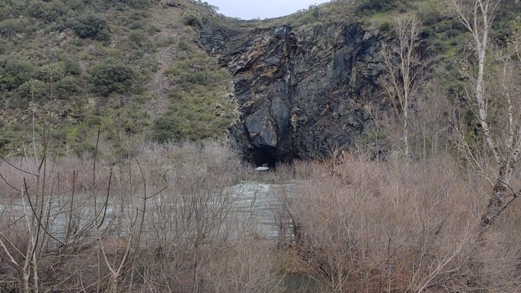
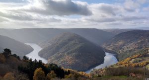
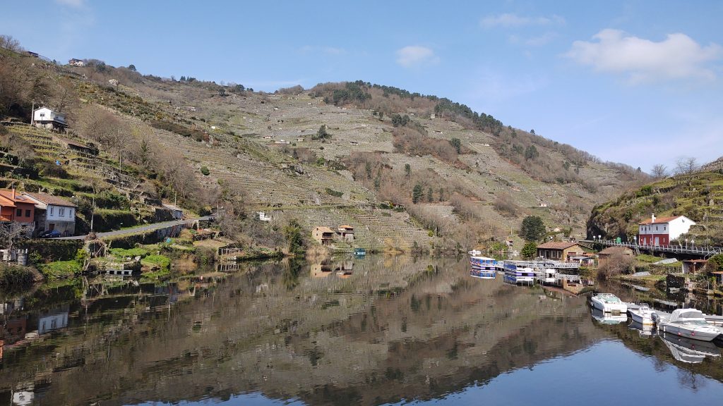
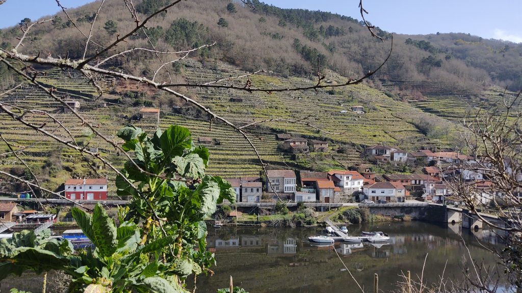
Cabo do Mundo Viewpoint

An iconic image of the Ribeira Sacra, this beautiful meander of the Miño River is so delightful that you will be enchanted.
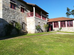
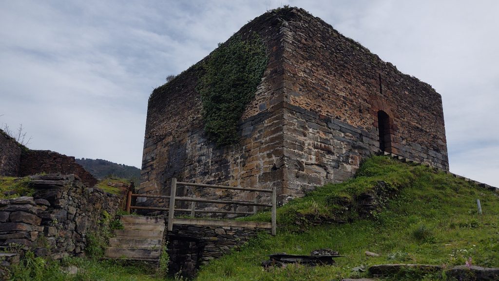
Arxeriz Ecomuseum

Do you want to get an idea of how life was in the Ribeira Sacra in the early 20th century? In this ethnographic museum, you will discover everything from a fort to a plantation of all the varieties of grapes of the Ribeira Sacra Designation of Origin, passing through the boat room or the room dedicated to the heroic viticulture tasks.

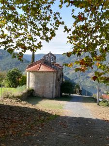
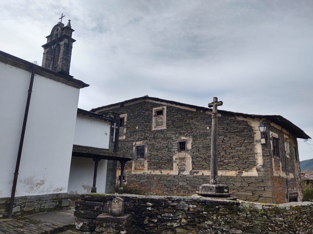
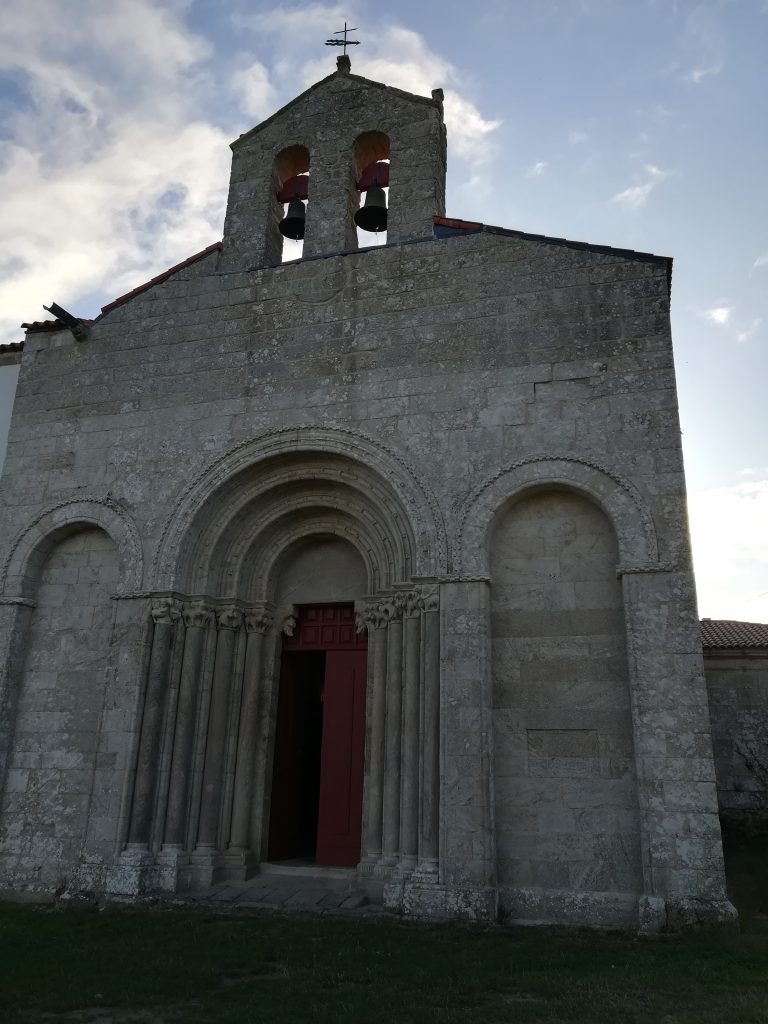
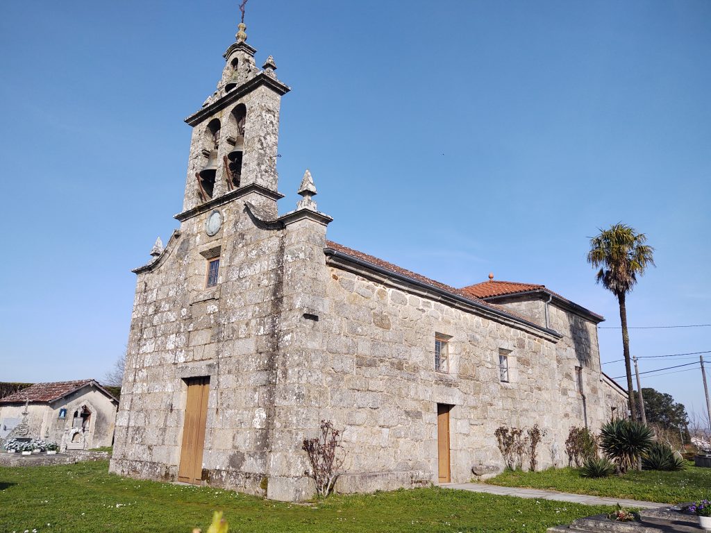
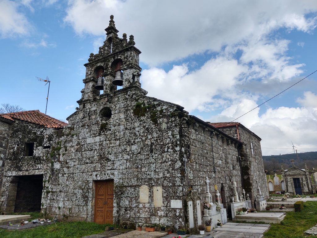
San Martín de A Cova

A beautiful Romanesque church that has been documented since 1262. It is located in a dreamy setting with Cabo de Mundo in the foreground.

Fontela - O Cerdeiro (3.1 km)

We continue on the LU-P-5817 road. In a continuous but gentle descent, we pass through small nuclei: Rosende, Vilaravides, Vilatiñosa, Sobradelo, Mourelos, and O Cerdeiro. In the latter, we find a “peto de ánimas” (soul chest), where pilgrims used to donate alms to free their deceased from purgatory.

Carretera hacia o Cerdeiro
Peto das ánimas

Cirdeiro - Church of San Paio de Diomondi (3.6 km)

We continue on the LU-P-5817 until A Vendanova, from which we can see the town of Chantada.

We continue descending and pass through O Outeiro and Montecelo. In the latter nucleus, amidst a Souto (a grove of chestnut trees), we find a crossroad indicating the Royal Way, which has a large stone resembling a plateau for placing either the saint during processions or coffins during funeral marches.

We leave the entrance to the Camino de Santiago to the right and head straight for the Monastery of San Paio de Diomondi.

The church is an example of Compostela Romanesque. It consists of a single nave divided into five parts, separated by attached columns. The main façade has blind arches, and the main door consists of four archivolts on marble shafts. We can read an inscription on the lintel indicating that it was placed in the year 1170.

In its beginnings, it was a double monastery where both nuns and friars lived, as indicated in documents from the year 954 that mention the donations made to the monastery. It was linked to the episcopal house of Lugo and used as a summer residence.

Declared a national monument in 1931, it is currently being prepared to be turned into a hostel.

Church of San Paio de Diomondi - Belesar Village (2.4 km)

Next to the church, near a shelter, we find a milestone indicating that we are 100 km from Santiago de Compostela. There are notes nearby saying that there are 108 km left.

Tighten the laces of your boots and get ready to descend this unforgettable and magical path known as Los Codos de Belesar. Feel the peace and tranquility that this route conveys, and do not be surprised if you encounter a druid in one of its corners.

Along this path, you can read more on our blog.

Vista de Belesar desde el puente

Let’s take a moment to enjoy the reflections of the Miño River and to contemplate the beautiful village of Belesar, with its 34 inhabitants, its vineyards, its refuge cellars, its swans…

*Refuge cellars are small single-story buildings used to store tools for wine cultivation. They also served as shelter for property owners during long days of work away from home. Fires could be made on the ground for heating or cooking. The door was protected by a grapevine to shield from the sun. These buildings are typical of the wine-producing area of Chantada.

We cross the new Belesar Bridge, which sits on the Roman bridge. Do you remember the Game of the Goose? We pass from the Monforte de Lemos Bridge to the Belesar Bridge. Both bridges used to be toll bridges, considered as pious works because their construction prevented the deaths of those crossing the river to reach the other side.

After regaining energy, we prepare for a steep climb because everything we descend on one slope, we have to climb on the other.

Belesar Village - San Pedro de Líncora (2.4 km)

Once we cross the Belesar Bridge, we enter the lands of Chantada.

We come across an explanatory panel of the Winter Way of Saint James, next to which a steep climb on the Roman road known as the “Codos de Belesar” begins. The slope is very steep, but there is a reward. With each stop we make to catch our breath, we can admire wonderful views of the village of Belesar, the Miño River, and the terraced vineyards.

Vista de Belesar desde la zona chantadina.

We exit onto the road and take a short journey on it, through the area of A Ermida. We pass by the “Vía Romana” winery, famous for its appearance in Dolores Redondo’s work “Todo esto te daré” (All This I Will Give You). In this winery, you can delight in the wine of the Ribeira Sacra Designation of Origin.

We leave the road to descend on a dirt path that leads to a mill with a stream, which we can cross using stone steps… unless there is so much water that we have to retrace our steps and return to the road, in which case we are at a place known as A Ponte da Ermida.

After passing through the nuclei of Vilanova, Os Queixeiros, and Alemparte, we leave the road to take a path that leads to Rubiás, which runs through centuries-old oak trees. This very steep stretch is made up of stones, remnants of the ancient Roman road.

Tramo de la antigua calzada romana que nos lleva a Rubiás

We reach the summit of San Pedro de Líncora, a small population of just 75 inhabitants, from which we can see the town of Chantada.

We begin to see the flatlands and large pastures, the source of cattle farming production.

Iglesia de San Pedro de Líncora

San Pedro de Líncora - Chantada (2.3 km)

The path follows the road that connects Líncora with Chantada.


We pass by the side of the Romanesque church of San Salvador de Asma, known as the Convent. Notable features include its cloister from the early 16th century and the coffered ceiling inside.


We enter Chantada, the heart of Galicia, through the A Ponte district, crossing a small bridge documented since 1290 that spans the Asma River, and we enter the center of Chantada with cobbled streets and noble houses with beautiful arcades.

Talking about Chantada means talking about Romanesque architecture, its old town, and the “Entroido Ribeirao” (the carnival of Santiago de Arriba).

The Entroido Ribeirao is one of the Galician carnivals that preserve the oldest traditions.

Would you like more information about this route?

You can contact us to get more information about how to complete this route.

4th Stage: Chantada - Rodeiro 25.3 Km

After enjoying the town of Chantada, we wake up with the hope of reaching the pinnacle of the Winter Way: the hermitage of Our Lady of O Faro.

This chapel is located in a revered place from ancient times, sung about by the troubadour Xoán de Requeixo in the 13th century. Many people make a pilgrimage to this miraculous Virgin, called “The Mother,” out of their deep faith.

The chapel is located in an area that is part of the Natura 2000 Network. With an altitude of 1,100 meters, it is the geographical point that separates the provinces of Lugo and Pontevedra. From its summit, you can see all four provinces that make up Galicia.

Despite its favourable location, this spot was never inhabited due to the strong winds that blow there, as evidenced by the wind turbines at the top of the mountain.

This final stage of the Camino de Santiago through the Ribeira Sacra has a medium to high difficulty, with the toughest stretch being the one that covers the distance between Penasillás and the hermitage.

Chantada – Centulle (1.6 km)

We leave Chantada from the Santa Ana square, taking Uxío Novoneyra Street, which leads us to Antas de Ulla, LU-P-1809.

About 400 meters from the town of Chantada, we turn left and enter the parish of San Xurxo de Asma, where we find this beautiful “peto de ánimas” (soul chest) along with an 18th-century fountain.

Peto de ánimas en Centulle

Centulle – Casasoa - San Xurxo (1.3 km)

We continue our journey and arrive at Casasoa, a nucleus with numerous rreos *(granaries), some of which are in a state of abandonment.

Hórreo en Casasoa

(*Hórreos are small buildings near houses used to store grain. They are supported on legs that have a stone on top, usually circular and called “tornaratos,” which functioned to prevent mice from accessing the stored grain.)

San Xurxo

We reach San Xurxo, where we find a stone house that serves as a community centre, an old school, with a beautiful cross located at a crossroads of roads, in this case, it merges with the LU-213, the old Lalín road.

San Xurxo - Lucenza (2.4 km)

To avoid asphalt, we turn right and about 100 meters later, turn left onto a dirt road that runs parallel to the fast lane connecting Chantada and Lalín. This path leads us to Boán, where we find a lovely rural house in an area of chestnuts and oaks. We continue and cross the road to reach Lucenza.

Lucenza - Penasillás (3.5 km)

We follow the road, and about 100 meters later, we turn left onto a dirt and stone path. After about 300 meters, we encounter the road, which we continue on with a slight ascent, leaving the nucleus of Vilaseco to the left.

As we approach, we catch a glimpse of the beautiful village of Penasillás, with just around 20 inhabitants, featuring a small chapel in the center and its “peto de ánimas,” probably from the 18th century. Upon leaving the square, to the left, we find another chest, this one older, dating back to the 17th century.

Penasillás was an important crossroads where this path converged with the one that connected Ourense with A Coruña and Betanzos without passing through Santiago de Compostela.

This charming little village has a recently restored square with its chapel, “petos” (soul chests), a communal oven, and a recovered well. In Penasillás, you can find a cantina and a rural house.

Penasillás: Capilla y Peto de Ánimas

From Penasillás, there are two options to reach Rodeiro:

-One follows the lower elevation and circumvents Mount Faro

-The other, more spiritual and historical, climbs to the hermitage of O Faro.


Penasillás – Hermitage of Our Lady of O Faro (4.6 km)

After regaining our strength, we start our journey on a cobbled and steep path.

The path runs along forest tracks, as the old road was lost due to reforestation efforts in the mountain. The ascent is continuous for about 2 km.

Around halfway through the stretch at Chao de Seixas, near the road, we find a rest area with a monolith that contains a poem by the local poet Pablo Rubén Eyré.

We continue ascending on the road, and a short distance from the summit, we have the option to complete the final part of the journey via the Via Crucis, known as the “Camino de la Virgen,” (the  Virgin Way) which is about 300 meters long.

Vía Crucis en el Monte de O Faro

Every September 8th, a pilgrimage takes place, and this is the path taken by devotees of Our Lady of O Faro, some of whom go barefoot or on their knees to bow before the image of the Virgin. This devotion seems to date back to the 6th century.

Hermitage of Our Lady of O Faro:

This hermitage, belonging to the parish of Santiago de Requeixo, underwent numerous renovations. Its Romanesque origins collapsed, and it was reconstructed in the second half of the 17th century and further renovated in 1726 and the 19th century.

Inside, you can find the image of the Old Virgin (la virgen vieja) or Mother, while in the church of Santiago de Requeixo, there is the image of the Virgin de Octava or Daughter. On September 8th, both images are brought together in an impressive procession with numerous devotees.

We can now say that we have been to the only point in Galicia from which you can see mountainous areas of all four Galician provinces.

Esta es una muestra de una cantiga de romería, variante de las cantigas de amigo.

Xoán de Requeixo (13th-century troubadour)

Fui eu, madr, en romaria
a Faro con meu amigo
e venho d´el namorada
por quanto falou comigo,
ca mi jurou que morria
por mi, tal ben mi quería!

Fui yo, madre, de romería
a Faro con mi amigo
y vengo de él enamorada,
por todo lo que habló conmigo
pues me juró que moría
por mí, ¡tanto me quería!
I went, mother, on a pilgrimage
to Faro with my friend,

and I return from there in love,
for he spoke to me,
for he swore to me that he would die
for me, such love he had for me!

I went, mother, on a pilgrimage
to Faro with my friend,
and I return from there in love,
for he spoke to me,
for he swore to me that he would die
for me, such love he had for me!

As we leave the province of Lugo and enter Pontevedra, our journey on the Winter Way of Saint James through the Ribeira Sacra comes to an end.

Hermitage of Our Lady of O Faro – Casa de Camba (7.7 km))

We have two alternatives: descend via the Via Crucis or the road. In either case, we need to reach a milestone indicating Km. 81.2.

Once we reach a crossroads, we continue to the right on a forest track with a steep slope and breathtaking views. The hum of the wind turbines accompanies us.

After about 5 km, we reach the bridge that crosses the corridor. We continue on a wide dirt path. Half a kilometer later, we encounter a large milestone indicating that we are on the Winter Way through Rodeiro.

We descend to Vilanova, ending up on a road that we continue on. In the distance, we see the Casa Fortaleza de Camba and its chapel, now the parish church of San Juan de Camba.

Camba Manor House and Church

The Manor House is known by various names, including Casa Fuerte de Camba or Casa de los Churruchaos, as it belonged to this noble family.

The Manor House features a tower and a chapel, now a parish church.

The chapel has Romanesque origins from the 12th century, but little remains of it as it underwent renovations and expansions in 1618, resulting in a Baroque-style facade.

The Fortaleza, with its two impressive chimneys, provided shelter for pilgrims.

In front of the Manor House and the Church, we find a “cruceiro” (stone cross) and a fountain.

Casa de Camba – Río (2.9 km)

Leaving the Fortaleza de Camba, we take a dirt road on the right.

We traverse the valley of A Ermida, where we find a “marco jurisdiccional” (jurisdictional boundary marker) of the Casa de Camba, called “del perdón” (of forgiveness). According to oral tradition, if a prisoner escaped from the fortress’s prison and was caught while embracing the marker, they would be forgiven.

After passing through the places of A Ermida, Outeriño, Fafián, and Lamazaros, we reach Río.

Here, we can admire the “pendellos,” which are sheds where products were displayed for sale on stones about half a meter above the ground, serving as counters during fair days. These constructions were used by traders to shelter from bad weather or spend the night.

Today, there is a cantina where you can have a drink.

Río – Rodeiro (1.7 km)

We continue towards Mouriz on a narrow and rocky path. We leave the nuclei of Vence and Vila to the right and Castro de Casasoa to the left.

We enter Rodeiro, a municipality with 2,500 inhabitants, and encounter a large staircase leading to the Town Hall, next to the stream named Rodeiro.

The Town Hall, also known as the Fortaleza de Rodeiro (Fortress of Rodeiro), is built on the ruins of a fortress.

The enclosure was walled, and the river Rodeiro formed the moat. It had two towers: one, the Tower of Homage, associated with the Camba family, and the other, linked to the Archbishop of Santiago de Compostela. The building was destroyed by the Irmandiños during the Irmandiña Revolt.

In front of the Town Hall, there is a beautiful stone fountain with four spouts.

Would you like more information about this route?

Queremos conocerte un poco más.
¿Con quién viajas?


En Familia

Turismo Movilidad Reducida


Con amigos o en pareja


¿Cuándo?

Aún no lo sé Tengo fechas fijas

¿Qué es lo que te más te apetece hacer?
(puedes seleccionar varios)


Enología

Románico

Literario

Naturaleza

Miradores

Camino Santiago
Al enviar mis datos acepto la Política de Privacidad
¡Quiero recibir novedades que me interesen sobre la Ribeira Sacra!